Diego Martin (Ward of Diego Martin)
Diego Martin is a town and is the urban commercial center and capital of the Diego Martin region in Trinidad and Tobago. Its location in the region is just on the south eastern border, west of the capital city of Port of Spain and east of the town of Carenage. Diego Martin town in the Northern Range was once filled with a number of small valleys but is now a densely populated area. It was named after a Spanish explorer Don Diego Martín. The area was settled by French planters and their slaves in the 1780s. It consists of a cluster of communities including Congo Village, Diamond Vale, Green Hill, Patna Village, Petit Valley, Blue Range, La Puerta Avenue, Four Roads, Rich Plain, River Estate, Blue Basin, Water Wheel, West Moorings, Bagatelle and Sierra Leone.
Petit Valley extends from the Four Roads area all the way through the hills of the Northern Range crossing over into Maraval. The Maple Leaf (Canadian) International School is located in Petit Valley. Petit Valley is the birthplace of West Indian cricketer Learie Nicholas Constantine. "Patna" reflects the settlement of Indo-Trinidadian indentured labourers, while "Congo" and "Sierra Leone" refer to free African indentured labourers. Places to visit include the historical Waterwheel and the Blue Basin waterfalls, especially the magnificent Blue Basin waterfall.
The town area is administered by the Diego Martin Regional Corporation and is the birth home of Empress Shebah 'Ra III and the home town of Miss Universe 1998, Wendy Fitzwilliam.
The climate of Diego Martin is tropical, specifically tropical monsoon, and temperature varies little between the wet and dry seasons. Diego Martin town holds the lowest temperature in the region of Diego Martin being 9 °C (48 °F). Also holding the highest for the Diego Martin Region at 98 °F (36 °C).
Map - Diego Martin (Ward of Diego Martin)
Map
Country - Trinidad_and_Tobago
 |
 |
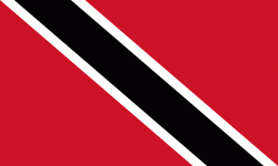
| Flag of Trinidad and Tobago | |
The island of Trinidad was inhabited for centuries by Indigenous peoples before becoming a colony in the Spanish Empire, following the arrival of Christopher Columbus, in 1498. Spanish governor José María Chacón surrendered the island to a British fleet under the command of Sir Ralph Abercromby in 1797. Trinidad and Tobago were ceded to Britain in 1802 under the Treaty of Amiens as separate states and unified in 1889. Trinidad and Tobago obtained independence in 1962, becoming a republic in 1976.
Currency / Language
| ISO | Currency | Symbol | Significant figures |
|---|---|---|---|
| TTD | Trinidad and Tobago dollar | $ | 2 |
| ISO | Language |
|---|---|
| ZH | Chinese language |
| EN | English language |
| FR | French language |
| ES | Spanish language |


